
DriveBC Webcams
What are DriveBC Webcams? Just in case you don’t know, Drive BC is a website, as well as a toll-free phone service for British Columbians.
It provides road conditions, weather conditions, and traffic information for travelers who are navigating the beautiful highways in British Columbia.
The service is run by the provincial government’s Ministry of Transportation. This website can help us drivers figure out when to travel, and which is the best route to take.
On the DriveBC website, you’ll be able to see
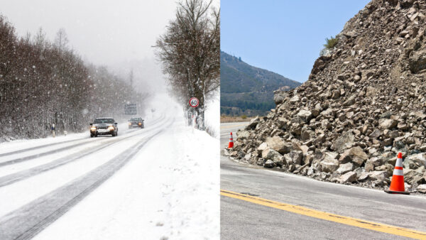
- Current road conditions, like slippery sections and poor visibility
- Incidents, like collisions and rock slides
- Future planned events, such as avalanche prevention, construction, and bridge maintenance
DriveBC Webcams – Map for BC Highways
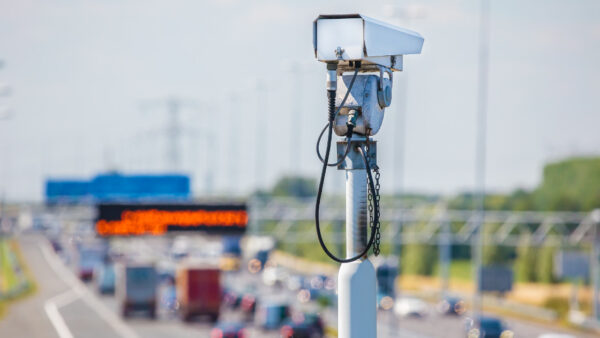
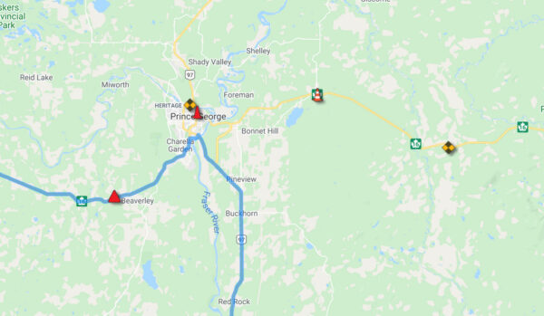
On the DriveBC map, you can click on highway webcam icons. When you click one, it will display recently captured images of highway conditions. The webcams are scattered around throughout the province.
Pretty cool to be able to look at a highway you’re planning on driving on, from the comfort of your own home (or anywhere).
DriveBC also shows weather information; current and forecast data is available. The weather information is recorded from weather stations. These are operated by the BC Ministry of Transportation or Environment Canada.
DriveBC Webcams
Northern Region Webcams – BC Highways Webcams
- Highway 2
- Highway 5
- Highway 16
- Highway 27
- Highway 29
- Highway 35
- Highway 37
- Highway 37A
- Highway 0 (Cecil Lake Road)
- Highway 97 (Northern Region)
- Highway 113
- Highway 118
Southern Interior Webcams – BC Highways Webcams
- Highway 1
- Highway 3
- Highway 3A – Okanagan
- Highway 3B
- Highway 5
- Highway 5 – Coquihalla
- Highway 6
- Highway 20
- Highway 23
- Highway 24
- Highway 26
- Highway 31
- Highway 31A
- Highway 33
- Highway 43
- Highway 93
- Highway 95
- Highway 95A
- Highway 97 – Southern Interior Region
- Highway 97A
- Highway 97C
- Highway 99 – Lillooet to Cache Creek
Lower Mainland Webcams – DriveBC Webcams – Highways Webcams
- Highway 1 – Horseshoe Bay to Lonsdale
- Highway 1 – Ironworkers Memorial Bridge To Port Mann
- Highway 1 – Fraser Valley
- Highway 7 – Lougheed Highway
- Highway 7B – Mary Hill Bypass
- Highway 9
- Highway 10
- Highway 11 – Abbotsford Mission Highway
- Highway 15 – Surrey – Whiterock
- Highway 17
- Highway 17A
- Highway 91A – New Westminster – Queensborough
- Highway 0 – Knight Street
- Highway 91 – Alex Fraser Bridge
- Highway 91 – East – West Connector
- Highway 91 – Delta
- Highway 99 – Whistler to Lillooet
- Highway 99 – Sea to Sky Highway
- Highway 99 – Lions Gate Bridge / Marine Drive
- Highway 99 – Oak Street Bridge / Richmond
- Highway 99 – George Massey Tunnel
- Highway 99 – Delta
- Highway 99 – Surrey / White Rock
- Highway 99A – King George Blvd
- Highway 101 – Sunshine Coast
Vancouver Island Webcams – DriveBC Webcams – BC Highways Webcams
- Highway 1 – Vancouver Island
- Highway 4
- Highway 14
- Highway 17 – Victoria
- Highway 18
- Highway 19
- Highway 19A
- Highway 28
Border Webcams – DriveBC Webcams – BC Highway Boarder Crossing Webcams
- Highway 11 – Canada / USA Border Crossing
- Highway 13 – Canada /USA Border Crossing
- Highway 15 – Canada / USA Border Crossing
- Highway 93 – Canada / USA Border Crossing
- Highway 99 – Peace Arch Border Crossing
Weather Warnings For British Columbia
Check out this British Columbia map to see potential current weather warnings.
Route Planning
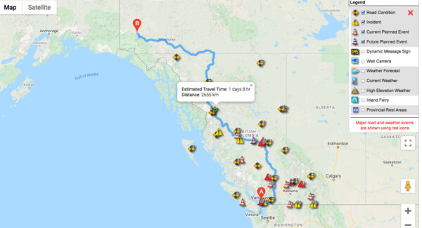
Did you know you can plan your route with DriveBC?
- Enter a start and end destination and get the shortest route with step-by-step instructions.
- DriveBC event information is included, such as BC Highway Webcams and Dynamic Message Signs (DMS) along your route.
- You can add personal notes and, if you like, print the instructions.
Please note that this DriveBC route planning tool won’t automatically route around events listed on DriveBC.ca
Reporting A Highway Problem In BC
You can report a highway problem to the Ministry of Transportation. Oftentimes, they don’t know there’s a problem until someone tells them.
There just aren’t enough resources for humans to be checking every square inch of our world every day all day.
Types Of Problems You Can Report
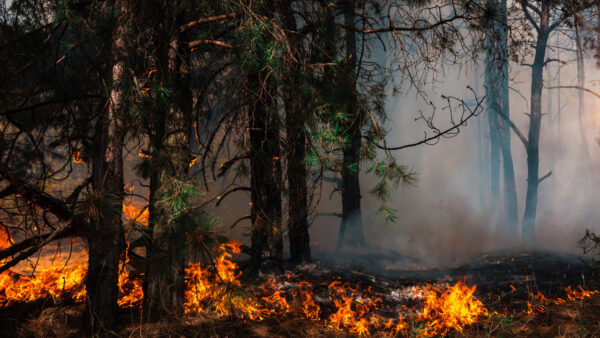
- Report a wildfire (BC Wildfire Management Branch)
- Report a chemical spill (EMBC)
- Report a downed power line (BC Hydro)
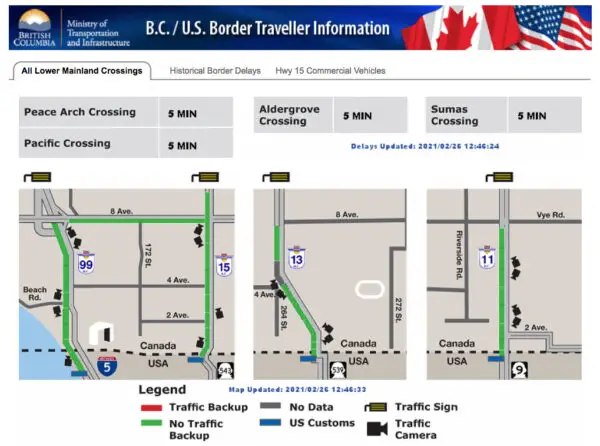
BC/U.S. Border Traveler Information
Check this out for current border wait times and potential delays.
BC Highway Conditions Toll-Free Number
What’s this, a telephone? Do people still use phones to make phone calls?
You can call the BC Highway Conditions Toll-Free number at 1-800-550-4997 if you’re a phone call type of person.
Read more on our blog: Driving High – The Truth & Why It’s Sketchy